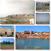
Tell Tweini
Archaeological tell in northwest SyriaTell Tweini, possibly the ancient town of Gibala, is a 12 hectare archaeological site located 1 kilometre east of the modern city of Jableh, Syria. It is situated within the coastal plain of Jableh, a short distance of two other main archaeological sites: Tell Sukas (5 km) and Tell Siyannu (6 km). As a tell, the site is the result of centuries of habitation on the same place, which resulted in a rising mound, as every new generation built their houses on top of the remains of older structures. The tell is sited about 1.7 kilometers from the coast but it appears that in the Bronze Age a sea incursion provided a harbor access to the sea.
Read article
Top Questions
AI generatedMore questions


